
13 Epic one day Hikes in Triglav National Park
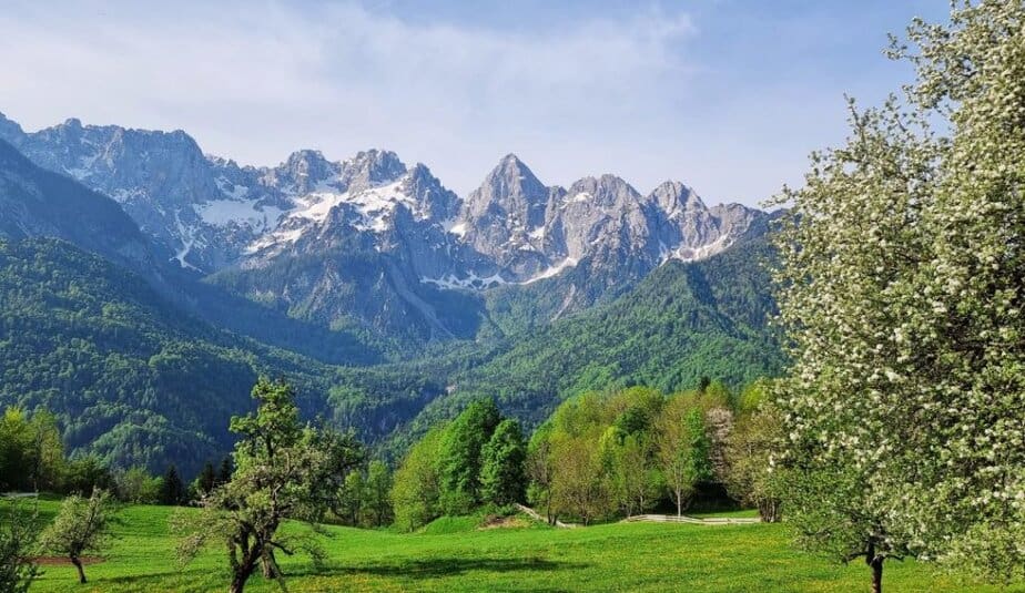
Triglav National Park is Slovenia’s only national park and one of the largest protected alpine areas in Europe. Covering nearly 840 square kilometers in the heart of the Julian Alps, the park protects crystal-clear rivers, dramatic mountain peaks, glacial valleys, waterfalls, and alpine meadows that make this part of Slovenia so unforgettable. The park is named after Slovenia’s highest mountain, Mount Triglav (2,864 m), a national symbol that even appears on the Slovenian flag.
What makes Triglav National Park especially unique is how accessible its landscapes are. In a single day, you can walk beside the emerald Soča River, visit hidden alpine lakes, hike to panoramic mountain ridges, or discover peaceful valleys surrounded by towering peaks. While the park is famous for demanding alpine climbs, it also offers countless scenic one day hikes that are suitable for most hikers with decent fitness and a love for nature.
In this guide, you’ll find 13 epic one day hikes in Triglav National Park — from the magical Krn Lakes and the stunning Seven Lakes Valley to easy panoramic trails above Lake Bohinj and unforgettable walks through the Soča Valley. These hikes are perfect if you want to experience the best of the Julian Alps without needing technical climbing skills or multi-day trekking experience.
Best One Day Hikes in Triglav National Park
- Krn lakes from Lepena
- Triglav lakes from planina Blato
- Prehodavci from Trenta
- Zapotok waterfalls
- Krn from planina Kuhinja
- Soča trail
- Slemenova špica
- Kriški podi from Zadnjica
- From Vogel Ski resort to Šija
- Triglavska Bistrica trail in Vrata valley
- Martuljek waterfalls
- Mangart saddle hike
- Lanževica from Savica
Whether you are visiting Slovenia for the first time or already exploring deeper into the Julian Alps, these hikes offer some of the most beautiful scenery in Triglav National Park. From peaceful alpine valleys and turquoise rivers to panoramic mountain viewpoints and hidden waterfalls, every trail on this list shows a different side of Slovenia’s wild alpine landscape. Most of these hikes can be done in a single day without technical climbing equipment, making them perfect for hikers, photographers, and nature lovers looking for unforgettable mountain experiences.
If you’re looking for more ideas for wonderful hikes in the Slovenian Highlands, check out the article below.
1. Krn lakes from Lepena
Route characteristics:
- Starting point: Lepena valley (46.304, 13.681)
- Trail time: cca 5 h
- Length of trail: 12 km
- Altitude difference along the way: 800 meters
- Starting height: 700 m
- The highest point: Krn lake 1391 m
- Trail difficulty: easy-marked trail
- GPX: You can get it hire
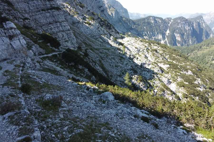
The hike to the Krn Lakes is one of the most beautiful and accessible alpine hikes in Triglav National Park. The trail starts in the stunning Lepena Valley and follows an old military mule track built during the period of the Rapallo border, when the Italians constructed roads and military infrastructure throughout the Julian Alps.
The first part of the hike climbs steadily through the forest above the Lepena Valley, while higher up the trail becomes much gentler. Before reaching the valley of the Krn Lakes, the path even descends slightly and opens beautiful views toward the surrounding peaks. Along the route you will also notice the cargo cable car that still supplies mounthain hut by Krn lakes today.
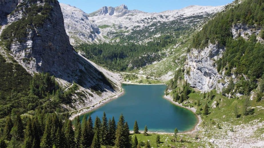
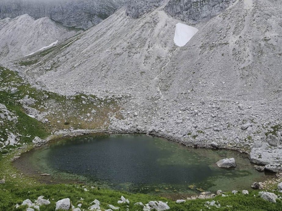
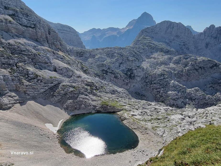
Just before reaching the hut, you can turn left and visit the small Dupelj Lake, the smallest of the three Krn Lakes. During late spring the lake looks especially magical, while in summer algae often appear because of grazing cattle nearby. Even so, the peaceful alpine surroundings make it worth the short detour.
About 15 minutes beyond the hut lies the stunning Krn Lake, the largest high-mountain lake in Slovenia. The lake is approximately 390 meters long and around 150 meters wide. From its shore, you get an incredible view of Mount Krn (2244 m), the dominant peak rising high above the valley.
This trail is also a great choice for families and children who are used to walking on uneven mountain terrain.

Triglav lakes from planina Blato
Route characteristics:
- Starting point: Planina Blato (46.311, 13.8501)
- Trail time: cca 7 h
- Length of trail: 18 km
- Altitude difference along the way: 1050 meters
- Starting height: 1150 m
- The hight of Triglav lake hut 1685 m
- Trail difficulty: partially demanding-marked trail
- GPX: You can get it hire
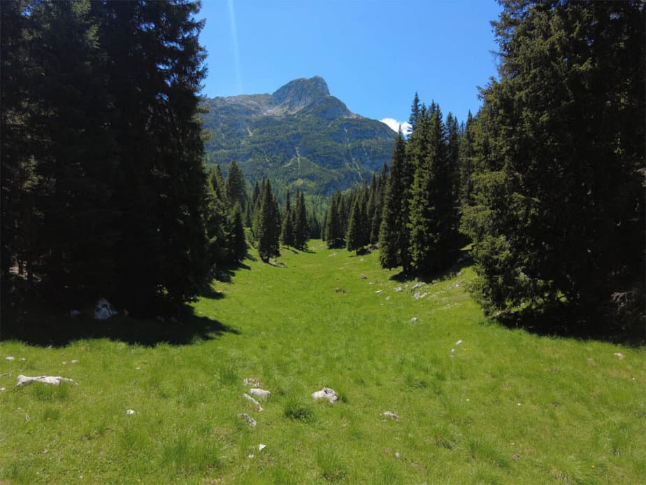
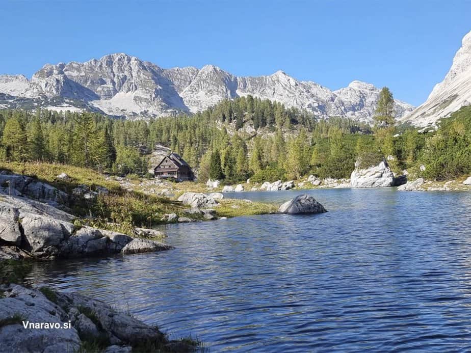
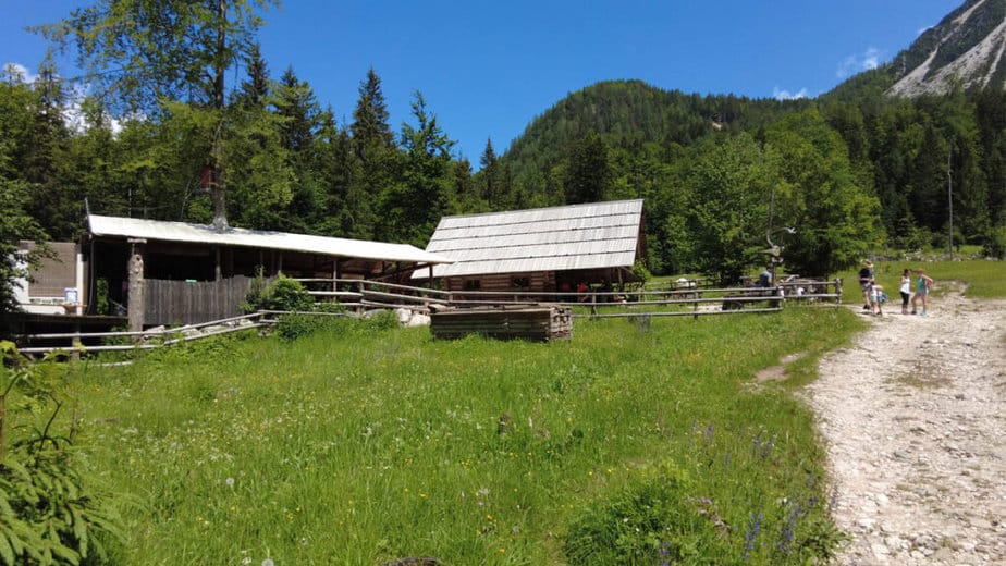
The hike to the Triglav Lakes Valley is one of the most beautiful and popular hikes in Triglav National Park. Starting from Planina Blato above Bohinj, the trail leads through peaceful forests, traditional alpine pastures, and some of the most magical scenery in the Julian Alps.
The first part of the hike takes us toward Planina pri Jezeru, one of the most picturesque alpine pastures in the area. From there, the trail climbs gently toward Planina Viševnik, where beautiful mountain views slowly begin to open up.
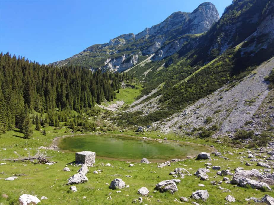
After Planina Viševnik, the trail continues through the forest toward Črno jezero. During wetter periods of the year, you can also spot one of the intermittent karst lakes beside the trail. Somewhere below the path, hidden beneath the steep cliffs of Komarča, you can hear the powerful waterfall crashing into the valley below. Although the waterfall itself is not visible from the trail, you can carefully walk toward the edge where the waterfall begins — but extra caution is absolutely necessary here because of the exposed terrain.
Hidden among dwarf pines and forest beneath steep mountain slopes, Črno jezero is one of the most atmospheric lakes in the entire valley and a perfect place for a short break before continuing higher into the heart of the Triglav Lakes Valley.
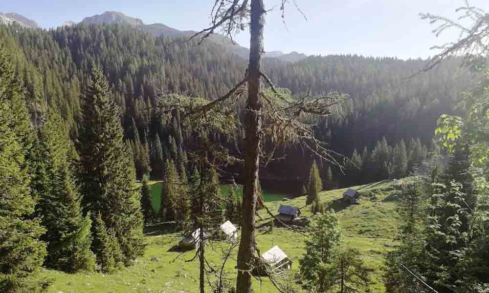
After leaving Črno jezero behind, the trail climbs steadily through the forest. The trees slowly begin to disappear just before reaching Koča pri Triglavskih jezerih and the famous Double Lake. Surrounded by rugged peaks and crystal-clear alpine scenery, this is easily one of the most iconic places in the Slovenian Alps.
For the return hike, we continue across the scenic Štapce saddle toward Planina Ovčarija and then descend via Planina Dedno Polje and Planina pri Jezeru back to Planina Blato. This circular route makes the hike much more diverse and offers even more beautiful views of the surrounding alpine landscape.
Prehodavci from Trenta (Triglav lakes)
Route characteristics:
- Starting point: Trenta valley (46.3806, 13.7524)
- Trail time: cca 9 h 30 min
- Length of trail: 20 km
- Altitude difference along the way: 1450 meters
- Starting height: 620 m
- The highest point: Prehodavci hut 2071 m
- Trail difficulty: easy-marked trail
- GPX: You can get it hire
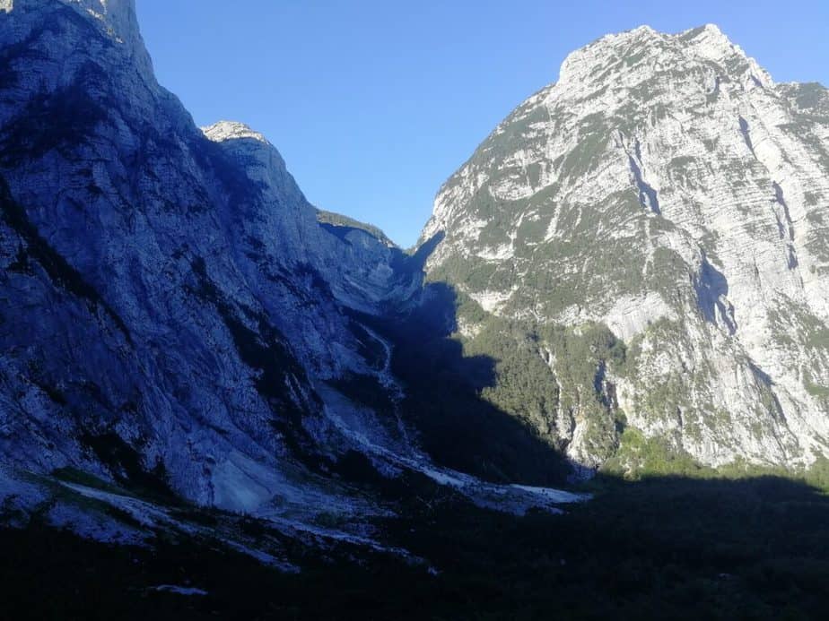
This circular hike to Zasavska koča na Prehodavcih is one of the most scenic long day hikes in Triglav National Park. Starting from the beautiful Trenta Valley, the route first climbs gradually along an old Italian military mule track before returning through the wild alpine landscape of the Zadnjica Valley.
The ascent from Trenta follows a historic military path almost the entire way. Because the trail was built for transporting supplies, the climb is surprisingly comfortable and never too steep despite the large elevation gain. The route winds through forests, crosses mountain streams, and slowly opens wider and wider views toward the surrounding Julian Alps. Higher up, the landscape becomes increasingly rugged and alpine.
After several hours of hiking, the trail reaches the area around Zasavska koča na Prehodavcih, located at 2071 meters above sea level. This part of the Triglav Lakes Valley feels much more wild and high alpine than the lower lakes around Double Lake and Črno jezero.
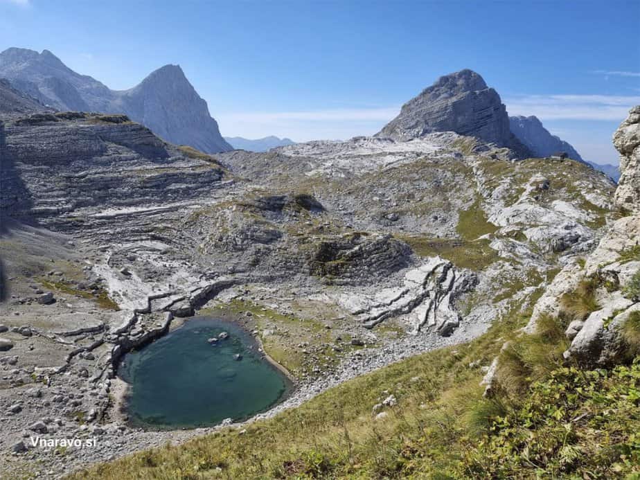
Several of the famous Triglav Lakes are located very close to the hut. The first one is Jezero pod Vršacem beneath the dramatic walls of Kanjavec and Vodnikov Vršac. Nearby lies Rjavo jezero, the highest lying lake in the Triglav Lakes Valley. Within a short walk from the hut, you can also visit Zeleno jezero and the tiny Jezero pod Vršaki beneath the cliffs of the Vršaki peaks. During dry summers, some of these lakes can shrink significantly or even partially dry out, but the scenery around them remains spectacular.
For the return, the trail descends toward the peaceful Zadnjica Valley beneath the massive walls of Kanjavec and Zadnjiški Ozebnik. The upper part of the descent crosses gravel and sand slopes where the terrain becomes slightly more rugged, while lower down the trail turns into an easier forest and shepherd path.
Part of the ascent and descent follows the same route near the junction below Zadnjiški Ozebnik, but most of the hike forms a beautiful and very diverse circular tour through one of the wildest parts of the Julian Alps.
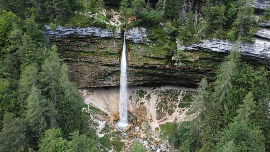
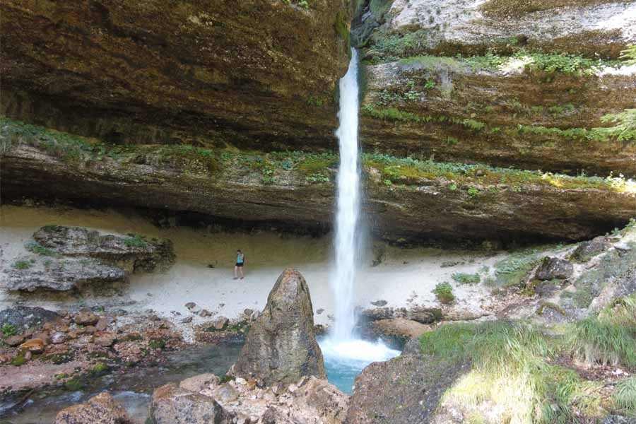
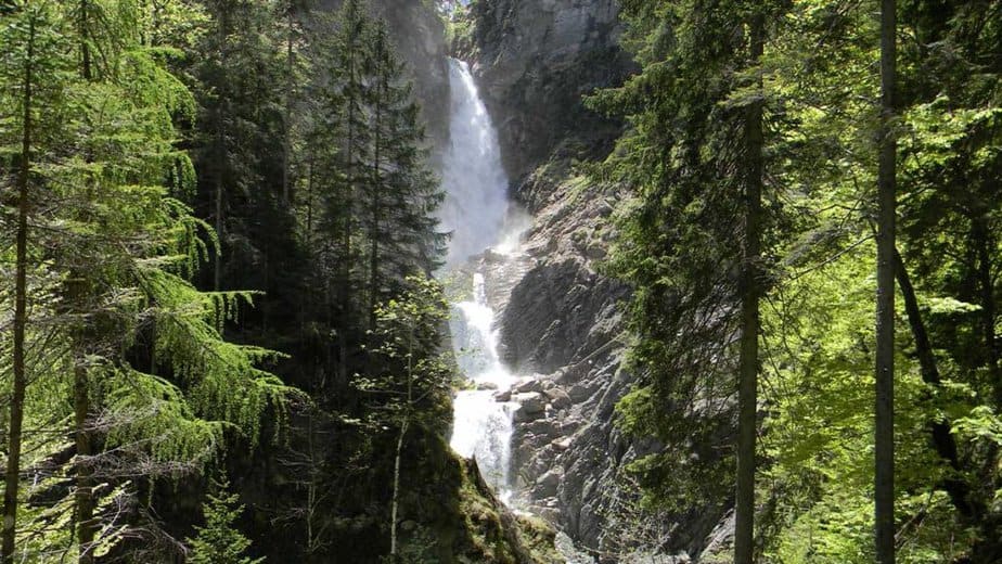
Zapotok waterfalls
Route characteristics:
- Starting point: Zadnja Trenta valley (46.4042, 13.7099)
- Trail time: cca 2 h
- Length of trail: 6 km
- Altitude difference along the way: 200 meters
- Starting height: 900 m
- The highest point: 1100 m
- Trail difficulty: easy-marked trail
- GPX: You can get it hire
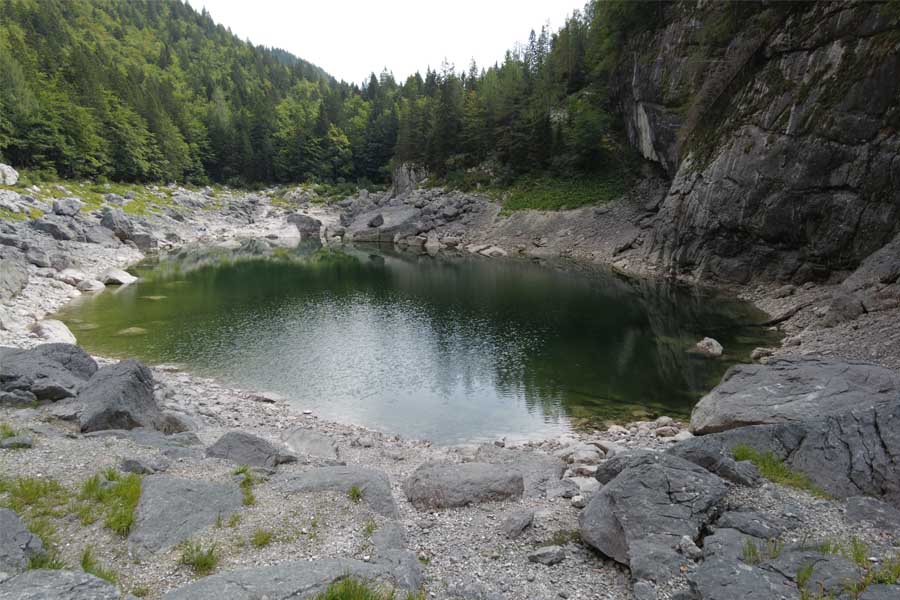
The Zapotok waterfalls are easily one of the most spectacular hidden gems in the Julian Alps. Hidden deep inside the wild gorge of the Suhi Potok stream in Zadnja Trenta Valley, this place feels completely untouched and incredibly remote despite being relatively easy to reach.
The waterfalls were created by the powerful Suhi Potok stream, which descends from the slopes beneath Bavški Grintavec. During normal water conditions, the stream disappears into the gravel riverbed shortly after leaving the gorge and only reappears lower in the valley near the Soča River.
The hike begins from the parking area that also serves as a starting point for climbs toward Mount Jalovec and Bavški Grintavec. Although the trail is not officially marked with hiking trail markers, wooden signs point the way toward the waterfalls and the path is generally easy to follow. The route mostly follows the right side of the stream and gradually enters an increasingly narrow and dramatic gorge.
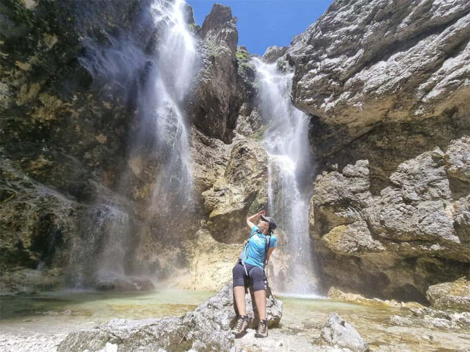
After around 30 minutes of walking, you will begin hearing the sound of water echoing through the canyon walls. Soon the first Zapotok waterfall appears — a stunning waterfall dropping into a crystal-clear emerald pool. Most visitors stop here, but the real magic of the gorge actually continues much higher upstream.
To continue toward the upper waterfalls, you need to walk slightly back from the first waterfall and find a small trail on the left side leading through the forest. The path is not officially marked, but it is usually visible enough to follow carefully. Higher up, the gorge reveals several additional waterfalls, smaller cascades, and beautiful turquoise pools hidden among the rocks.
The further you continue, the more spectacular the scenery becomes. Near the upper part of the gorge, the trail becomes rougher and more adventurous, occasionally crossing slippery rocks beside the stream. One of the upper waterfalls can be seen sliding down a massive rock wall high above the gorge, while the final large waterfall hidden around the bend is truly breathtaking — a powerful double waterfall dropping into a wild amphitheater of rock and moss.
Although technically not a difficult hike, extra caution is needed throughout the gorge, especially after rain, because rocks can become extremely slippery. Still, for nature lovers and waterfall enthusiasts, this is one of the most unforgettable short hikes in Triglav National Park.

Krn from planina Kuhinja- circular tour
Route characteristics:
- Starting point: Planina Kuhinja (46.241, 13.663)
- Trail time: cca 7 h 30 min
- Length of trail: 15 km
- Altitude difference along the way: 1350 meters
- Starting height: 1250 m
- The highest point: Krn 2244 m
- Trail difficulty: easy-marked trail
- GPX: You can get it hire
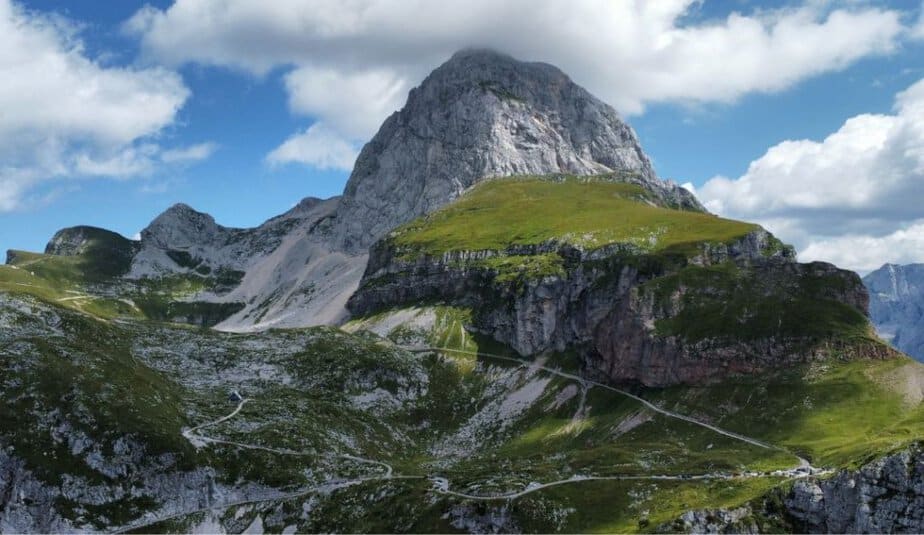
This circular hike to Mount Krn is one of the most scenic and diverse mountain tours in Triglav National Park. Along the route, you will visit one of the Krn lakes, walk through dramatic alpine valleys, explore World War I history on Batognica, and finish the hike with one of the best panoramic summits in the Julian Alps.
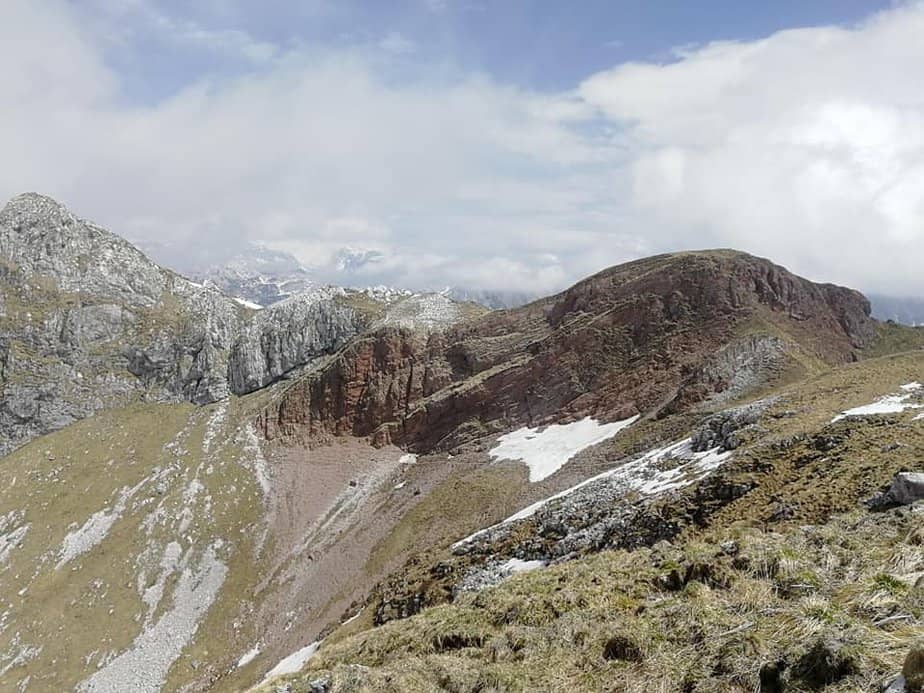
The hike starts at Planina Kuhinja, reached by a narrow but spectacular mountain road high above the Soča Valley. Shortly after the parking area, the trail turns right toward Planina Leskovca. Above the pasture, the path begins climbing more steeply beneath the striking reddish slopes of Rdeči rob.
Below Rdeči rob, the trail turns left into the beautiful valley beneath Peski. After roughly 20 minutes, you reach a saddle with an incredible view toward Jezero v Lužnici, one of the three famous Krn lakes. Hidden beneath the surrounding peaks, the lake creates a truly magical alpine atmosphere.
The route then continues across the valley beneath Peski all the way to the saddle between Batognica and the Peski ridge. From here, it takes only around 15 minutes to reach the summit of Batognica, a mountain completely marked by the scars of World War I. Even today, the summit area is filled with trenches, tunnels, caverns, and military remains from the Isonzo Front.
One of the most famous stories connected to Batognica comes from the war itself. During one of the battles, Italian forces occupied roughly two thirds of the mountain while Austro-Hungarian soldiers defended the remaining part. Both armies planned to dig tunnels beneath enemy positions and use explosives. According to the story, Austro-Hungarian soldiers discovered the Italian tunnel first, removed the explosives, and detonated them beneath the Italian positions instead — an explosion so powerful that it supposedly lowered the summit itself.

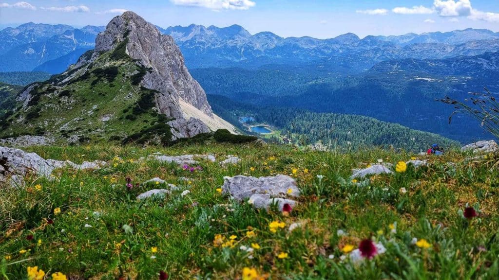
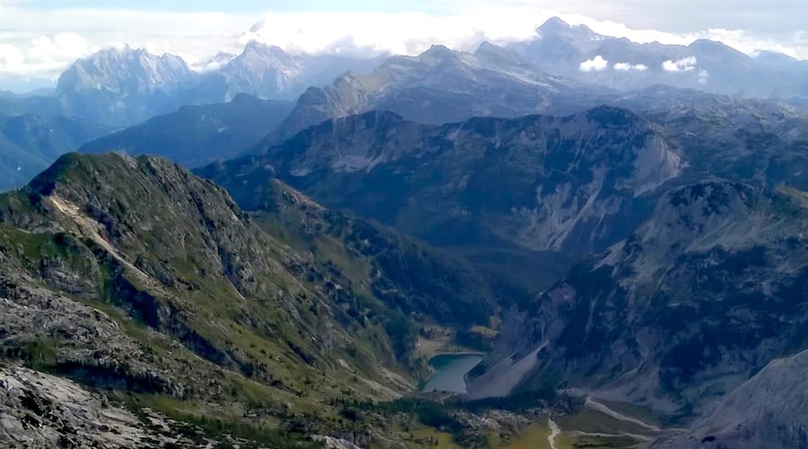
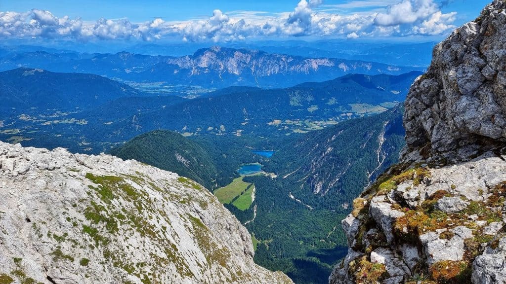
From Batognica, the trail descends slightly toward the scenic Krn Saddle before the final 30-minute ascent to the summit of Krn. From the top, the views stretch across the Soča Valley, the Julian Alps, the Adriatic side of Slovenia, and deep into the Dolomites on clear days.
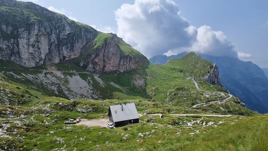
The descent follows the normal route back toward Planina Kuhinja. Although technically easy, the long grassy slopes can feel endless, especially in the summer heat. Most of the trail follows an old military mule track that climbs the mountain in wide switchbacks. Around ten minutes below the summit, you also pass Gomiščkovo zavetišče na Krnu, a popular mountain shelter just beneath the peak.
Because Krn rises only around 50 kilometers from the Adriatic Sea, weather conditions can change surprisingly quickly and the summit is often covered in clouds even when nearby mountains remain clear. For the best experience, it is highly recommended to start early in the morning and choose a stable weather forecast.

Soča trail
Route characteristics:
- Starting point: Soča sorce (46.4091, 13.7257)
- Trail time: cca 8 h
- Length of trail: 27 km
- Altitude difference along the way: 330 meters
- Starting height: 900 m
- The highest point: Soča spring 1000 m
- Trail difficulty: easy-marked trail
- GPX: You can get it hire
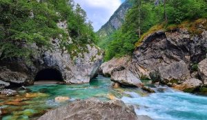
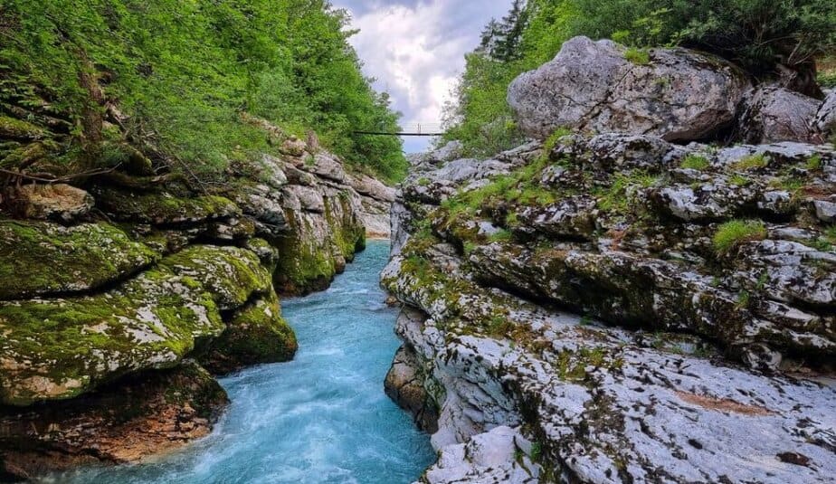
The Soča Trail is one of the most beautiful long-distance hikes in the Slovenian Alps. Stretching from the source of the legendary Soča River all the way to Bovec, the trail follows the emerald river through peaceful forests, narrow gorges, hanging bridges, alpine meadows, and countless hidden corners of the Trenta Valley.

Although the trail is around 27 kilometers long, it is technically very easy and suitable for almost anyone who enjoys spending a full day in nature. Most of the route stays close to the river itself, constantly revealing different faces of the Soča — from wild rapids and deep gorges to calm turquoise pools that almost invite you to jump in, even though the water rarely gets warmer than 10°C.
The hike begins near Source of the Soča River in the upper part of Trenta Valley. Reaching the actual spring requires a short detour and also the most demanding section of the entire trail, where the final meters are protected with steel cables. Emerging directly from beneath the limestone cliffs, the source of the Soča is one of the most magical places in Triglav National Park.
As the trail descends toward Trenta, it passes several fascinating natural and cultural attractions. One of the first is the monument dedicated to Julius Kugy, the legendary mountaineer and explorer of the Julian Alps. Nearby, you can also visit the dramatic Mlinarica Gorge and the beautiful Juliana Alpine Botanical Garden, the oldest alpine botanical garden in Slovenia.
Further down the valley, the Soča becomes calmer and even more colorful. Along the route you pass enormous boulders brought down by avalanches and rockfalls from the surrounding mountains, constantly reminding visitors that nature in the Julian Alps is still very alive and constantly changing.

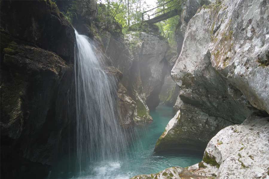
One of the highlights of the trail are the famous Mala Korita Soče and Velika Korita Soče. The Small Soča Gorge is incredibly narrow in places — at its narrowest point, the river is less than a meter wide. During normal water levels, some adventurous visitors even jump into the calm pools here.
The Great Soča Gorge is even more impressive. Stretching for around 800 meters, the gorge features deep emerald pools, narrow rock walls, and countless small waterfalls dripping from the cliffs above. At the end of the gorge, you will also find one of the most popular swimming spots along the entire Soča River.
One of the best things about the Soča Trail is that you can easily adapt it to your own pace and fitness level. Since the trail often stays relatively close to the main road through the valley, you can shorten the hike almost whenever you want. Still, the real beauty of this trail comes when you take your time, stop by the river, enjoy the views, and simply experience the incredible atmosphere of the Soča Valley.

Slemenova špica
Route characteristics:
- Starting point: Vršič pass (46.4358, 13.7449)
- Trail time: cca 2 h 30 min
- Length of trail: 5 km
- Altitude difference along the way: 350 meters
- Starting height: 1611 m
- The highest point: Slemenova špica 1911 m
- Trail difficulty: easy-marked trail
- GPX: You can get it hire
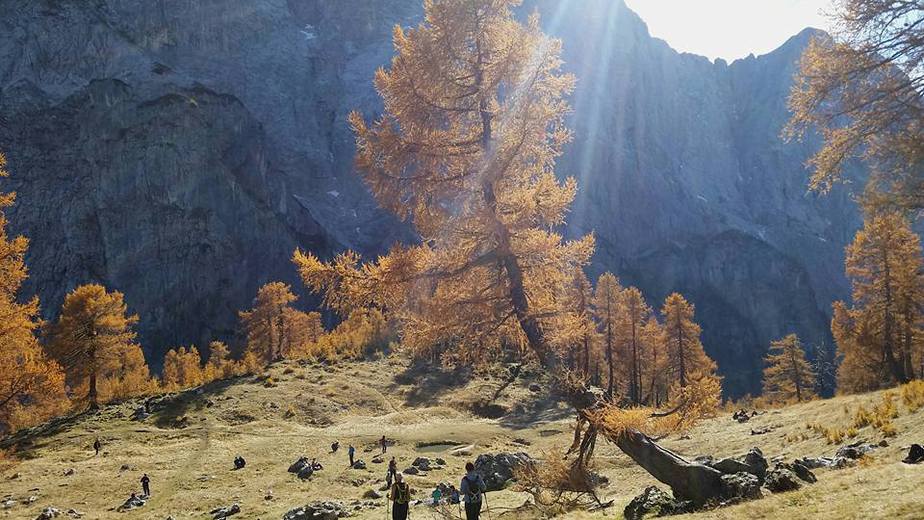
The hike to Slemenova Špica is one of the most popular and photogenic hikes in the Slovenian Alps — especially during autumn, when the surrounding larch trees turn golden yellow and completely transform the landscape.
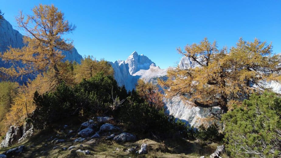
Every season in the mountains has its own charm. Spring brings fresh green colors and waterfalls full of energy, summer offers long warm days, while autumn creates a much calmer atmosphere with beautiful shades of yellow, orange, and brown. And few places in Triglav National Park capture that autumn magic better than Slemenova Špica.
The hike starts from Vršič Pass, the highest mountain pass in Slovenia. The road crossing Vršič was built during World War I by Russian prisoners of war, whose memory is still preserved at the famous Russian Chapel beside the road below the pass.
From the top of Vršič, the trail first heads slightly north before quickly climbing toward the small saddle beneath Mala Mojstrovka. This is the steepest part of the entire hike and takes around 20 minutes. Once you reach the saddle, incredible views open toward the Ponca mountains and the grassy slopes of Slemenova Špica. Even during the ascent, you can already admire some of the most iconic peaks of the Julian Alps, including Škrlatica, Prisojnik, and Špik.
From the saddle onward, the trail becomes much easier and more relaxed. The path gently crosses the plateau beneath the towering walls of Mala Mojstrovka before climbing again through sparse larch forest toward the beautiful grassy slopes below the summit.
As you step onto the open slopes near the top, the view toward Mount Jalovec becomes absolutely breathtaking. The sharp pyramid of Jalovec rising above the golden larches is one of the most famous mountain views in Slovenia.
If you continue all the way to the top of the grassy summit, you will also enjoy fantastic views toward Planica, Tamar Valley, the valley of Mala Pišnica, the Karawanks, and the dramatic ridge of the Ponca mountains.
Despite its incredible scenery, the hike itself remains relatively easy and is suitable for families and casual hikers who are comfortable walking on mountain trails.

Kriški podi from Zadnjica
Route characteristics:
- Starting point: Zadnjica valley (46.3824, 13.7619)
- Trail time: cca 11 h
- Length of trail: 18 km
- Altitude difference along the way: 1400 meters
- Starting height: 640 m
- The highest point: Pogačnik hut 2050 m
- Trail difficulty: easy-marked trail
- GPX: You can get it hire
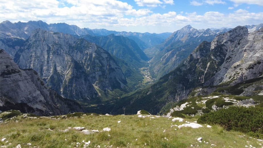
The hike to Kriški Podi is one of the most beautiful alpine hikes in Slovenia. Surrounded by dramatic limestone peaks, crystal-clear mountain lakes, and huge rock walls rising directly above the valley, Kriški Podi truly feels like a hidden mountain paradise high in the heart of the Julian Alps.
The hike starts in the stunning Zadnjica Valley above Trenta, one of the wildest and most impressive valleys in Triglav National Park. Towering above the valley are massive mountains like Kanjavec and the surrounding peaks of the central Julian Alps.
From the parking area, the route first follows a gravel road deeper into the valley beside the roaring Krajcarica stream. After roughly 15 minutes, signs direct the trail left toward Kriški Podi, while the main valley continues toward Dolič and Luknja. Soon after, the road ends at the lower station of the cargo cable car supplying the hut above.
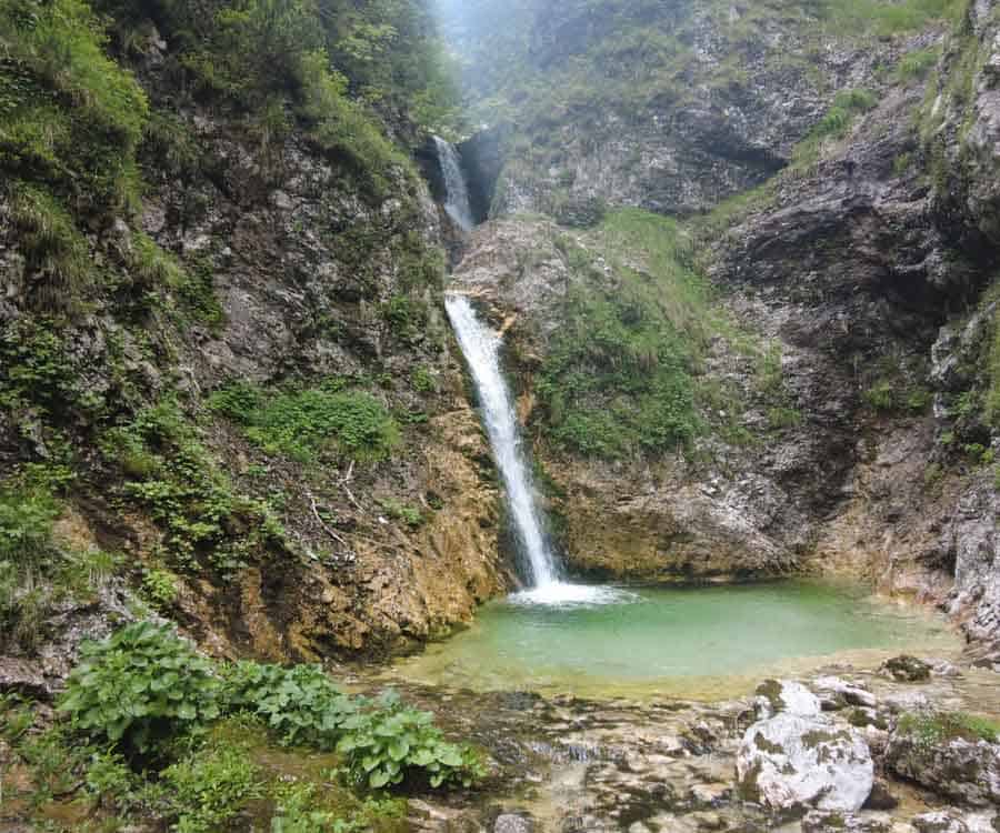
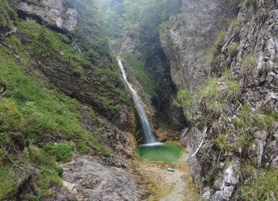
Right beside the cable car station, you can also make a short detour to a beautiful waterfall and emerald pool on the Beli Potok stream — a perfect little hidden gem before the real climb begins.
From here onward, the trail follows a spectacular old military mule track built by the Italians during the period of the Rapallo border. Even today, the path feels like a true masterpiece of alpine trail construction. The trail climbs steadily through the forest in countless switchbacks, crossing several torrent gullies beneath steep mountain walls.
As you gain elevation, more and more spectacular views begin opening toward Trenta and the surrounding peaks. Higher up, above the tree line, the scenery becomes truly breathtaking. The views toward the valley below grow wider with every step, while the rocky alpine world around Kriški Podi slowly reveals itself. Around half an hour below the hut, you also reach a spring where many hikers refill their water bottles before the final climb.
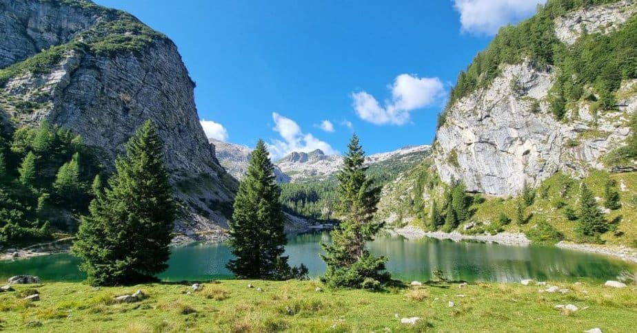
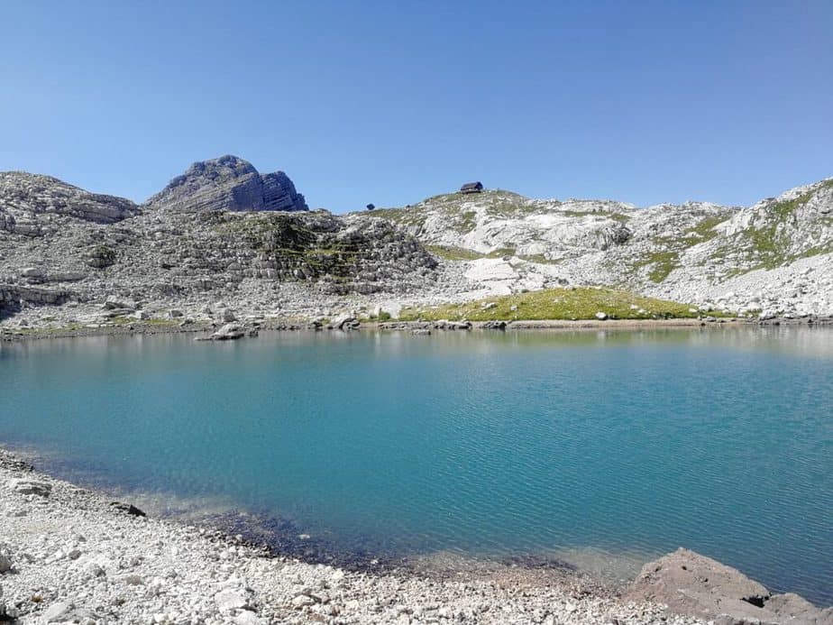
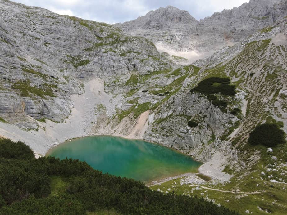
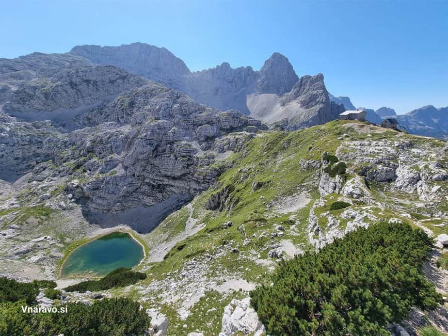
Just a few minutes off the main trail lies the spectacular Spodnje Kriško jezero, the largest and probably most beautiful of the three Kriška lakes. Surrounded by grassy slopes filled with alpine flowers and massive rock walls above, the turquoise water creates one of the most magical alpine scenes in Slovenia.
Above the lake already stands Pogačnikov dom na Kriških podih, located on a panoramic terrace high above the valley. Few mountain huts in Slovenia have such an incredible view toward Trenta and the surrounding mountains.
Kriški Podi is also an excellent starting point for several popular alpine summits. Relatively accessible peaks like Stenar and Križ rise directly above the plateau, while more demanding climbs lead toward Razor, Bovški Gamsovec, and Pihavec.
Despite the large elevation gain, the trail itself remains technically easy and is perfect for hikers who want to experience true high alpine scenery without difficult climbing sections.

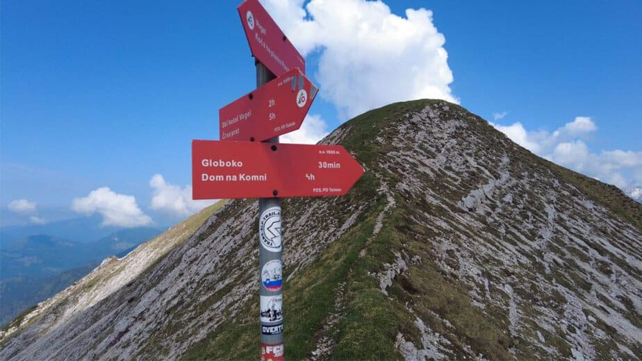
From Vogel Ski resort to Šija
Route characteristics:
- Starting point: Ukanc (46.2757, 13.8358)
- Trail time: cca 2 h 30 min
- Length of trail: 5 km
- Altitude difference along the way: 310 meters
- Starting height: 1540 m
- The highest point: Šija 1840 m
- Trail difficulty: easy-marked trail
- GPX: You can get it hire
After several more demanding alpine hikes, this is one of the easiest and most accessible panoramic hikes in Triglav National Park. Šija is a grassy peak in the ridge of the Southern Bohinj Mountains rising above the famous Vogel Ski Resort.

Most visitors reach the area using the cable car from Ukanc and continue higher with the chairlift, which means the actual hike to the summit only takes around 30 to 45 minutes. Because of this, Vogel is one of the most visited mountain destinations in Slovenia and for many tourists also their very first experience of the high mountains.
The Vogel cable car operates throughout most of the year and offers an easy way into the alpine world even for families with small children or visitors without much hiking experience. Once above the tree line, the terrain around the ski resort becomes surprisingly gentle and perfect for shorter walks and panoramic hikes.
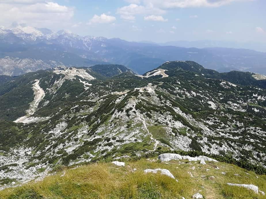
The trail toward Šija is technically very easy and follows wide grassy slopes above the ski resort. Along the route, beautiful views constantly open toward Lake Bohinj and the surrounding mountains. As you gain a little elevation, the panorama becomes even more spectacular.
From the summit of Šija, you get one of the most impressive panoramic views in the Julian Alps. Directly in front of you rises the mighty group around Mount Triglav, while to the east you can admire the ridge of the Southern Bohinj Mountains with Rodica. On clear days, the views stretch all the way toward the Karawanks, the Kamnik–Savinja Alps, the Škofja Loka hills, and even deep into Primorska.
Because the hike is short, technically undemanding, and incredibly scenic, Šija is an excellent destination for families, beginner hikers, and anyone who wants to experience the beauty of the Slovenian Alps without a long or exhausting climb. The area around Vogel also offers plenty of mountain food and traditional dairy products, making the whole experience even more enjoyable.
Triglavska Bistrica trail in Vrata valley
Route characteristics:
- Starting point: Vrata valley (46.449, 13.924)
- Trail time: cca 6 h
- Length of trail: 20 km
- Altitude difference along the way: 400 meters
- Starting height: 600 m
- The highest point: Aljažev dom 1000 m
- Trail difficulty: easy-marked trail
- GPX: You can get it hire
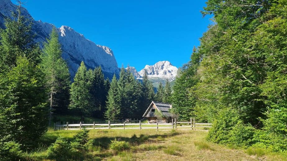
The Triglavska Bistrica Trail is one of the most beautiful and relaxed hikes in Vrata Valley. Instead of climbing high into the mountains, this trail takes you deep beneath the legendary north face of Mount Triglav, through forests, glacial moraines, riverbeds, and peaceful alpine scenery.
The hike begins near the famous Peričnik Waterfall, one of the most spectacular waterfalls in Slovenia. Reaching the waterfall takes only around 15–20 minutes of easy walking from the parking area. The lower Peričnik waterfall drops freely for around 52 meters over a massive cliff and is especially impressive because visitors can actually walk behind the curtain of water. Just above it lies the smaller Upper Peričnik waterfall, which adds another 16 meters of free fall and completes one of the most iconic waterfall scenes in the Julian Alps.
After visiting Peričnik, the trail continues along the valley road for the first few hundred meters before a small sign directs the route onto a much quieter forest path. The trail gradually changes from a gravel road into an old forest track and eventually into a pleasant hiking trail.
Although the trail is named after the Triglavska Bistrica stream, the river is surprisingly hidden for much of the route. The true highlights of the hike are the incredible water galleries carved into the glacial moraine thousands of years ago. These narrow passages and cavities constantly drip and flow with water, especially during spring and autumn when the stream carries more water through the valley.
Walking beneath these galleries is a unique experience. Water pours from cracks, holes, and tiny openings in the moraine walls, creating countless small waterfalls and streams all around the trail. In wetter periods, staying completely dry here is almost impossible.
Further up, the trail briefly rejoins the main valley road before turning back onto smaller forest paths leading toward abandoned mountain pastures and deeper into the valley. The route is generally well marked, although some sections are occasionally damaged by floods and torrents, so a little improvisation and basic orientation skills may be needed. Crossing the Triglavska Bistrica can also require removing your hiking shoes during periods of higher water.
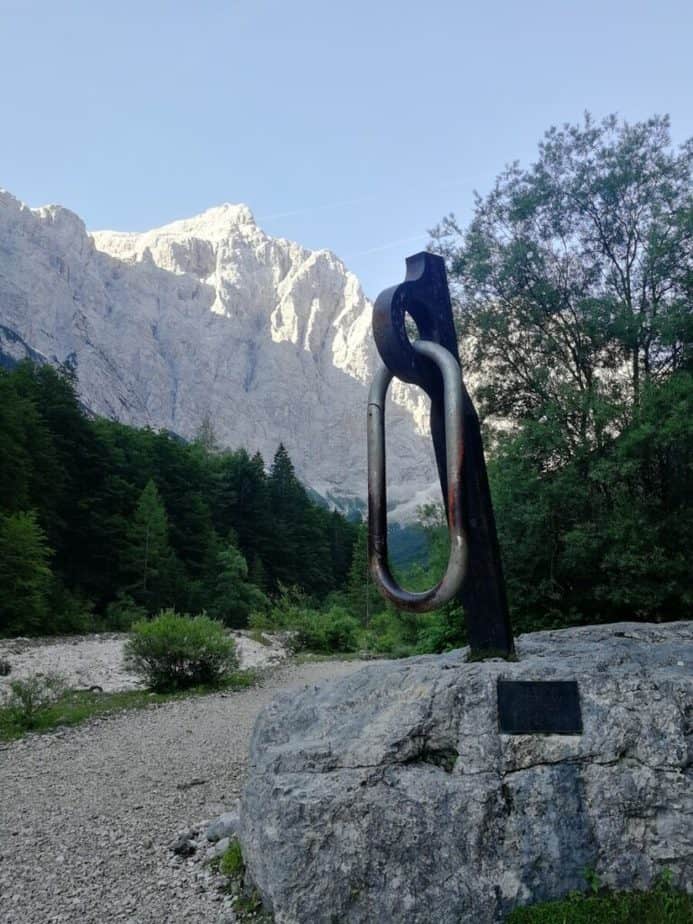
Eventually, the trail reaches Aljažev dom v Vratih beneath the enormous north face of Triglav. If you still have some energy left, it is highly recommended to continue a few hundred meters further to the famous giant climbing piton monument and viewpoint toward the north wall of Triglav — one of the most iconic alpine views in Slovenia.
Despite its length, this hike is technically very easy and perfect for families, casual hikers, and anyone wanting to experience the dramatic atmosphere of the Julian Alps without a demanding mountain ascent.
Martuljek waterfalls
Route characteristics:
- Starting point: Gozd Martuljek (46.4845, 13.8426)
- Trail time: cca 3 h 15 min
- Length of trail: 8 km
- Altitude difference along the way: 450 meters
- Starting height: 750 m
- The highest point: Upper Martuljek waterfall 1150 m
- Trail difficulty: demanding-marked trail
- GPX: You can get it hire
The hike to the Martuljek Waterfalls is one of the most beautiful waterfall hikes in the Slovenian Alps. Even before the hike begins, the scenery already feels spectacular. The view toward the mighty Špik Group above Gozd Martuljek is easily one of the most impressive mountain panoramas in Slovenia.
The trail starts just beyond the bridge over the Sava Dolinka river, where a well-organized parking area stands beside the cycling and walking path. Soon, yellow hiking signs marked “slap 1,2” guide the way toward the waterfalls and into the wild Martuljek gorge.
The first part of the route follows a fascinating educational forest trail filled with information about the local nature, traditional use of wood, alpine culture, and old forestry techniques. Along the way, you can also see a traditional charcoal-making area and several beautifully arranged educational points that make the hike even more interesting for families and casual visitors.
After around 10 minutes of walking, the trail reaches the entrance of the gorge. At first the valley feels calm and peaceful, with gravel riverbeds and crystal-clear pools perfect for relaxing during hot summer days. But soon the gorge narrows dramatically beneath steep vertical walls and the atmosphere becomes much wilder.
The trail through the gorge is beautifully maintained and secured where necessary. After roughly 15 minutes of climbing through the gorge, you reach the stunning Lower Martuljek Waterfall. Especially during spring, when snowmelt fills the stream with water, the waterfall and the entire gorge become incredibly powerful and impressive.
Just above the first waterfall, the trail splits. You can either return back toward the valley in a circular route or continue higher toward Planina Jesenje and the Upper Martuljek Waterfall. From here onward, the route temporarily leaves the gorge and continues through peaceful forest on a pleasant and technically easy trail.
Along the way, signs invite hikers toward the mountain hut at Planina Jesenje and also toward the small Finžgar Chapel hidden in the forest. Both are excellent short detours, especially on the way back down.
The final descent into the gorge beneath the Upper Martuljek Waterfall becomes much steeper and more adventurous. Steel cables help with the more exposed sections, especially near the waterfall itself. From the first viewpoint, you already get an incredible view of the entire waterfall, but if you want to approach the base of the 48-meter-high cascade, you will need to climb a steep rocky section secured with cables and iron pegs.
Because the upper gorge lies deep in the shade beneath north-facing cliffs, snow and ice can remain here well into spring. During periods of dangerous conditions, the trail near the upper waterfall may even be temporarily closed.
Despite a few steeper and exposed sections near the upper waterfall, this hike remains one of the most rewarding short mountain adventures in Triglav National Park.

Mangart sedle hike
Route characteristics:
- Starting point: Predel viadukt (46.4235, 13.5936)
- Trail time: cca 6 h
- Length of trail: 13 km
- Altitude difference along the way: 940 meters
- Starting height: 1100 m
- The highest point: Mangart sedle 2050 m
- Trail difficulty: easy-marked trail
- GPX: You can get it hire
The hike toward Mangart Saddle is one of the most scenic mountain hikes in the Julian Alps. While many visitors experience the famous Mangart road only from a car window, hiking toward the saddle allows you to fully enjoy the incredible alpine scenery surrounding one of the most dramatic roads in Slovenia.
The route starts near the Predel area and climbs mostly along mountain trails, only occasionally crossing the road. The ascent is pleasant and surprisingly varied, constantly opening wider views toward the surrounding mountains. Throughout the hike, you can admire the massive walls of Loška Stena with its highest peak Briceljk, while on the opposite side rise the peaks of Kanin Mountains with Mount Kanin, Prestreljenik, Jerebica, and Rombon dominating the horizon.
As the trail gains elevation, impressive views also open toward the mighty Montaž group across the border in Italy.
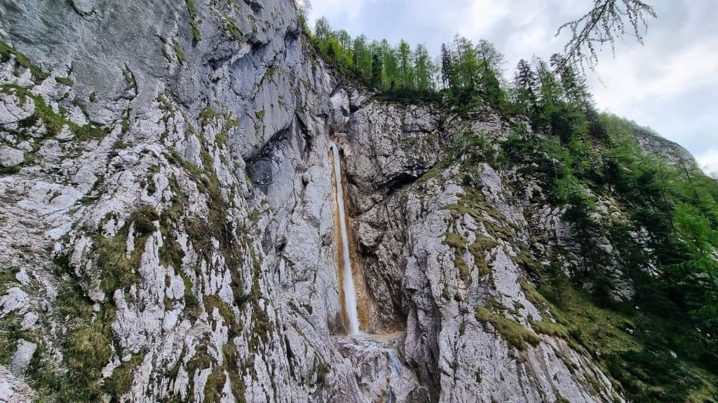
Only shortly before the upper part of the road does the trail follow the asphalt for a few hundred meters. Just beneath the final tunnel, however, the hiking path turns left and climbs above the tunnel itself instead of passing through it. This section is especially scenic and gives hikers a much better perspective of the incredible engineering hidden beneath the cliffs.
The trail then continues toward the upper slopes above Koča na Mangartskem sedlu before finally reaching the road again near the very top of the saddle. Here, one of the most spectacular panoramas in the Julian Alps suddenly opens up. Far below lie the famous Belopeška jezera (lakes), while the views stretch deep into both Austria and Italy.
Despite the dramatic surroundings, the route itself remains technically easy and suitable for most hikers with decent fitness. Because of the incredible scenery, panoramic views, and unique alpine atmosphere, this is easily one of the most rewarding hikes in the entire western part of Triglav National Park.
Lanževica from Savica
Route characteristics:
- Starting point: Savica (46.289, 13.802)
- Trail time: cca 9 h
- Length of trail: 24 km
- Altitude difference along the way: 1350 meters
- Starting height: 650 m
- The highest point: Lanževica 2003
- Trail difficulty: easy-marked trail
- GPX: You can get it hire
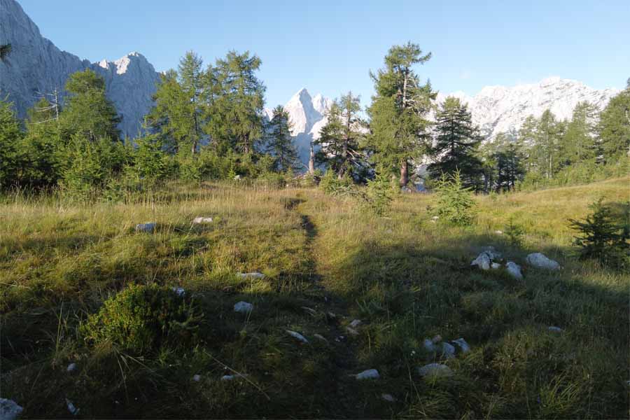
For the final hike on this list, we head to one of the quietest and most underrated peaks in the Julian Alps. Lanževica may not be among the most famous mountains in Slovenia, but it offers a fantastic combination of peaceful alpine scenery, beautiful views, and surprisingly easy hiking terrain.
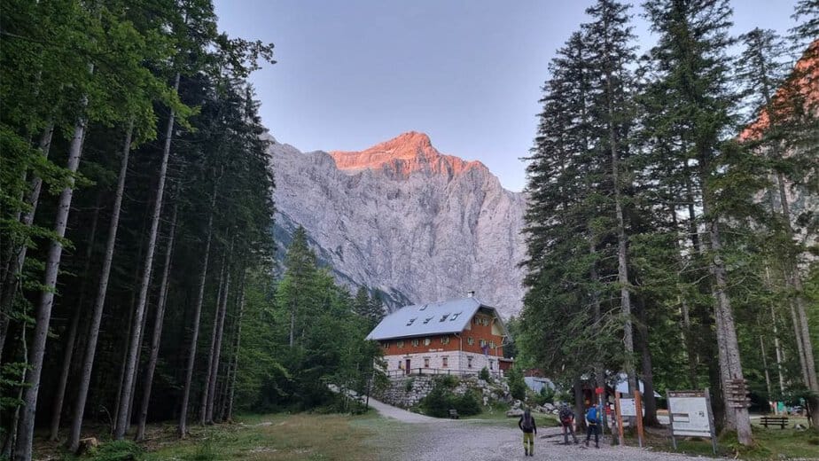
The hike begins at the parking area near Savica Waterfall above Bohinj. From the hut beneath the waterfall, the trail immediately starts climbing along an old military mule track built during World War I. In exactly 50 long switchbacks, the beautifully engineered path climbs steadily through the forest toward the plateau of Komna.
Because the mule track was designed for transporting supplies, the ascent is surprisingly comfortable despite the large elevation gain. The trail climbs steadily all the way to Dom na Komni, where the terrain finally begins to flatten out. From there onward, the route continues almost completely flat across the Komna plateau toward Koča pod Bogatinom.
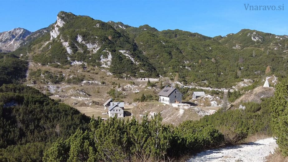
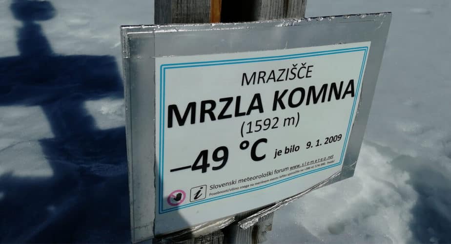
At Koča pod Bogatinom, the actual circular route begins. Here, I recommend turning toward Lepa Komna, the quieter and much less visited side of the plateau. Around 20 minutes beyond the hut, the trail passes through the area known as Mrzla Komna, considered the coldest place in Slovenia. In 2009, temperatures here reportedly dropped to an incredible -49°C.
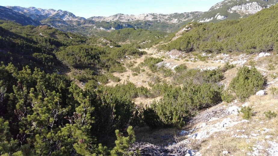
The trail then continues gradually across open alpine terrain toward Lanževica, mostly following the old military mule track almost all the way to the summit. The landscape here feels peaceful and remote, surrounded by dwarf pines, grassy slopes, and wide views across the Julian Alps.
Technically, the hike remains easy the entire time and is suitable for almost anyone with decent fitness and basic hiking experience. The broad grassy summit of Lanževica offers beautiful panoramic views toward Komna, the mountains above the Triglav Lakes Valley, and much of the central Julian Alps.
For the descent, the route first returns toward the saddle beneath Lanževica, where you leave the ascent route and continue toward Bogatin Saddle. From there, the trail descends back toward Koča pod Bogatinom before continuing across Komna and down the old mule track toward Savica.
This circular route is one of the best ways to experience the peaceful alpine world of Komna without any technical difficulties, making Lanževica a perfect final hike for this list of unforgettable one day hikes in Triglav National Park.

Conclusion
No matter which hike you choose, Triglav National Park will almost certainly leave you wanting to come back for more. From peaceful alpine valleys and emerald rivers to panoramic summits and hidden waterfalls, the Julian Alps offer endless opportunities for unforgettable one day adventures.
And that is probably the greatest beauty of these mountains — every trail feels a little different, yet each one somehow captures the same wild and magical spirit of Slovenia’s alpine world.